Detection of land degradation risk in Azerbaijan by combining fractional cover estimates based on DESIS data with multi-decadal Landsat NDVI trends
Asam, Sarah , Schwarzenbacher, Frederic , Marshall Ingram, David , Bachmann, Martin
2025-08-02 INTERNATIONAL JOURNAL OF REMOTE SENSING 2025 null(卷), null(期), (null页)
JCR分区:
影响因子:
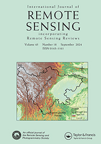
Land degradation is a significant environmental issue, exacerbated by climate change and land use pressures. Mountain grassland ecosystems, especially in arid regions, are particularly vulnerable to degradation, leading to reduced vegetation density, biomass and biodiversity, and contributing to soil erosion. While traditional monitoring methods are costly and time-consuming, remote sensing using multispectral data offers a more efficient way to assess large areas continuously. A key challenge in monitoring land degradation, however, is distinguishing between different vegetation cover fractions (fCover) of photoactive vegetation (PV), non-photoactive vegetation (NPV) and bare soil (BS). Hyperspectral data provide better spectral resolution to address this challenge by identifying diagnostic absorption features, but their availability is limited. This study investigates the potential of combining multispectral Landsat and hyperspectral DLR Earth Sensing Imaging Spectrometer (DESIS) data for mapping land degradation risk in Azerbaijan at 30 m spatial resolution. PV was derived for 18 DESIS scenes with a mean average error of 7.1%. Regarding the multi-decadal NDVI time series, 3.8% and 4.9% of the herbaceous vegetated area showed significant negative trends in June and August, respectively. By scaling the BS fCover, negative NDVI trend coefficients and slope steepness maps to a risk score, a degradation risk map for the central-western part of Azerbaijan was generated. Areas prone to degradation were mapped mainly on south-exposed slopes. This approach has high potential for identifying areas recently prone to degradation, facilitating early interventions to prevent the loss of valuable topsoil.
相关推荐
- The EnMAP spaceborne imaging spectroscopy mission: Initial scientific results two years after launch [2025-08-02]
- Seasonal Vegetation Trends for Europe over 30 Years from a Novel Normalised Difference Vegetation Index (NDVI) Time-Series-The TIMELINE NDVI Product [2025-08-02]
- Combining Field and Imaging Spectroscopy to Map Soil Organic Carbon in a Semiarid Environment [2025-08-02]
- Predictions of soil surface and topsoil organic carbon content through the use of laboratory and field spectroscopy in the Albany Thicket Biome of Eastern Cape Province of South Africa [2025-08-02]